Hello!
I’m Dror Bogin, a GIS developer and open source GIS advocate, this is my personal site.
You can read about me, check out some of the projects I’ve worked on, talks I gave, or find my contact information (also at the bottom).
I’m currently working on moving my blog here, and doing so chronologically, so if you’re looking for a specific post, it might not be here yet, but you can find a link to the old blog in the blog page.
-
-
QGIS Curved RTL Label Fixer Plugin - Behind the Scenes
By Dror Bogin Looking for the plugin? You can find it on GitHub and QGIS Hub. [Read More]
 -
QGIS Sound Effects Plugin - Behind the Scenes
By Dror Bogin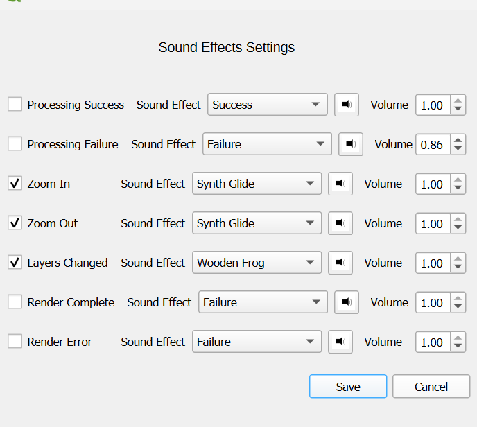 Looking for the plugin? You can find it on GitHub and QGIS Hub. [Read More]
 -
MapLibre Symbol Utils - A new MapLibre GL JS symbology plugin
By Dror Bogin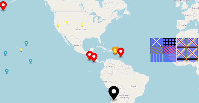 TL;DR: MapLibre Symbol Utils is a new plugin for MapLibre GL JS that allows you to create line pattern fills for your layers or use the MapLibre default marker class (which is very flexible) as an icon image for your point layers. You can see some examples of the changes... [Read More]
 -
Use MapLibre Marker for Entire Layers
By Dror Bogin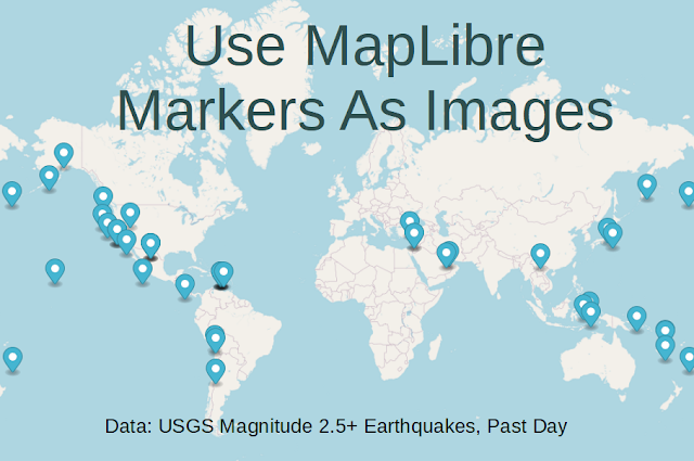
-
Invasion! or How To Copy Polygons With Expressions in QGIS
By Dror Bogin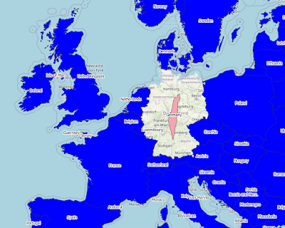 [!NOTE] This is an old post, I have since learned a lot about the QGIS expression engine and how to use it to its full potential. I’ll leave this post here for posterity, but I would recommend jumping to the end of the post to see what I’ve learned since... [Read More]
 -
Exploring The QGIS Expression Engine, Part 4: Selecting By Attributes And Location With One Expression
By Dror Bogin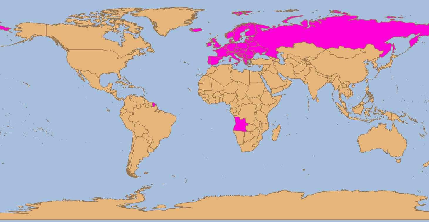 I recently encountered a Facebook post asking whether any GIS software can select by both attributes and location with one tool. My answer: [Read More]
 -
Beyond Expressions: What To Do When QGIS Expressions Go Too Far And Get Too Complex?
By Dror Bogin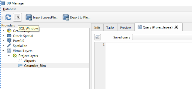 I got to writing this after having tried grouping points in polygons with expressions for too long, even with aggregate. so what do you do when expressions fail you? [Read More]
 -
Exploring The QGIS Expression Engine, Part 3: Writing Custom Expression Functions
By Dror Bogin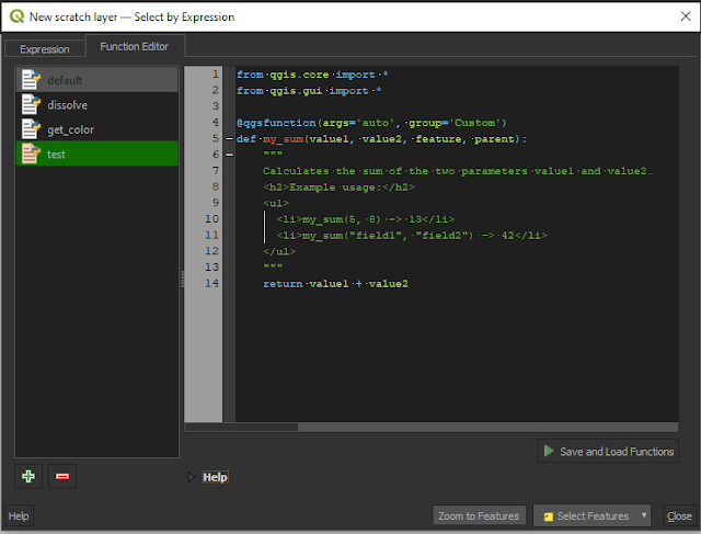 Jump ahead to the new stuff Jump ahead to the part about writing the function help [Read More]
 -
Exploring The QGIS Expression Engine, Part 2: What's Missing From Select By Location
By Dror Bogin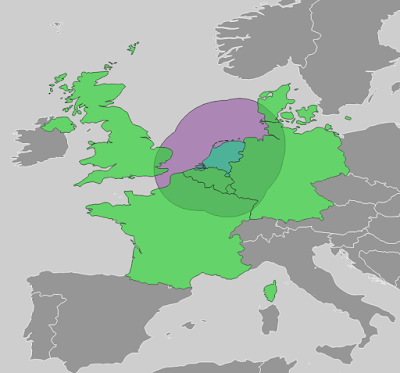 How To Select Within Distance [Read More]
 -
Exploring The QGIS Expression Engine, Part 1: Getting Values From JSON & HSTORE
By Dror Bogin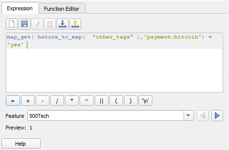 This will be the first post of as many as I get around to write about using the QGIS expression engine for selection, geometry generation and calculations to speed up and automate some analysis. [Read More]
 -
Using Polygons As Markers
By Dror Bogin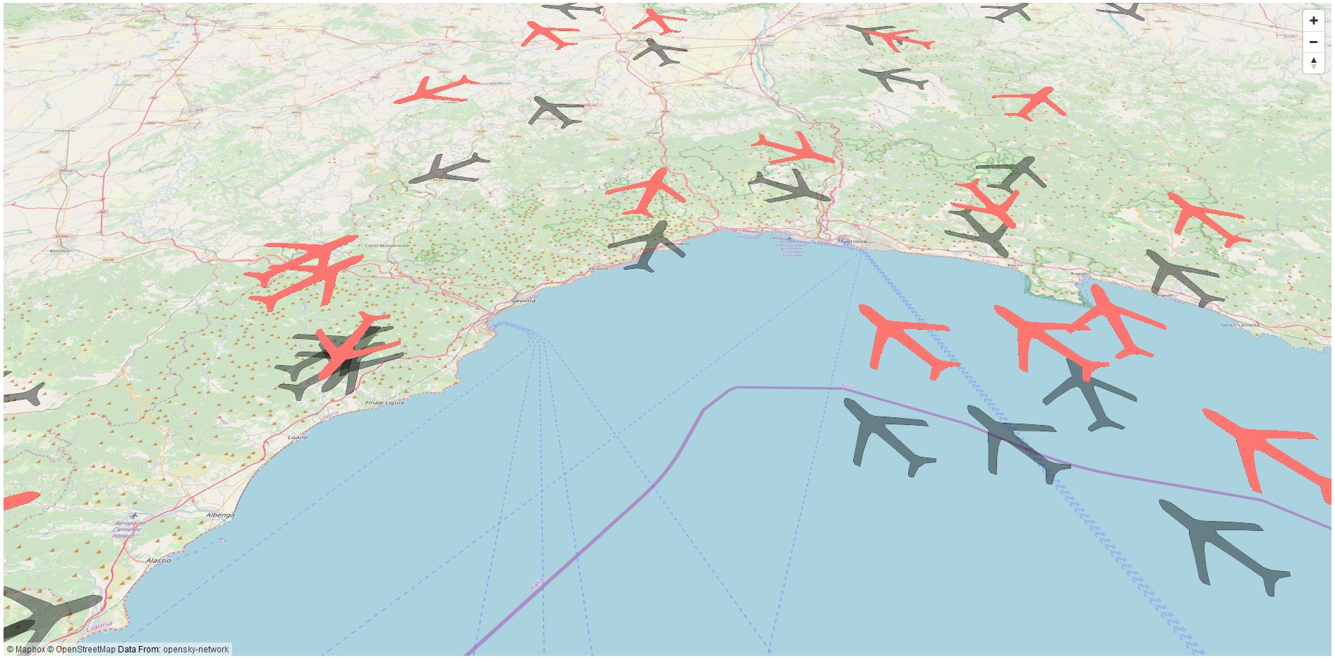 How I Got Into This [Read More]
 -
Using URL Parameters in GeoServer Views
By Dror Bogin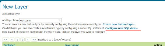 This method is great when trying to serve a layer with a lot of detailed features that covers a large area, like land parcels. Instead of getting the full layer for your web map, you can just limit visibility of the layer for specific zoom levels and query the view... [Read More]
 -
Creating A Static Cache of XYZ tiles with GeoServer
By Dror Bogin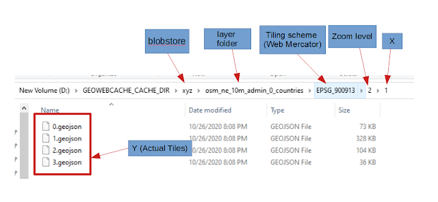 TL;DR : skip to the guide, follow the pretty pictures, create static cache for image or vector tiles in any format. This one is more of a virtual post-it note than anything else.The first time I had to create a static cache of tiles (vector or image) from GeoServer I... [Read More]
 -
How To Overwrite A GeoPackage Raster
By Dror Bogin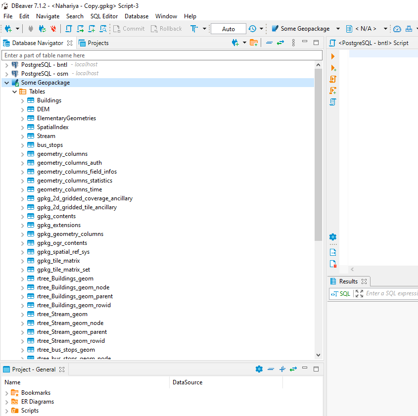 This came to me as somewhat of a shock, I was bounty hunting at gis.stackexchangewhen I came across this question and took a look at the GDAL formats docs.Apparently, you can't overwrite a raster stored inside a GeoPackage. It's simply not one of the options. But you can however overwrite... [Read More]